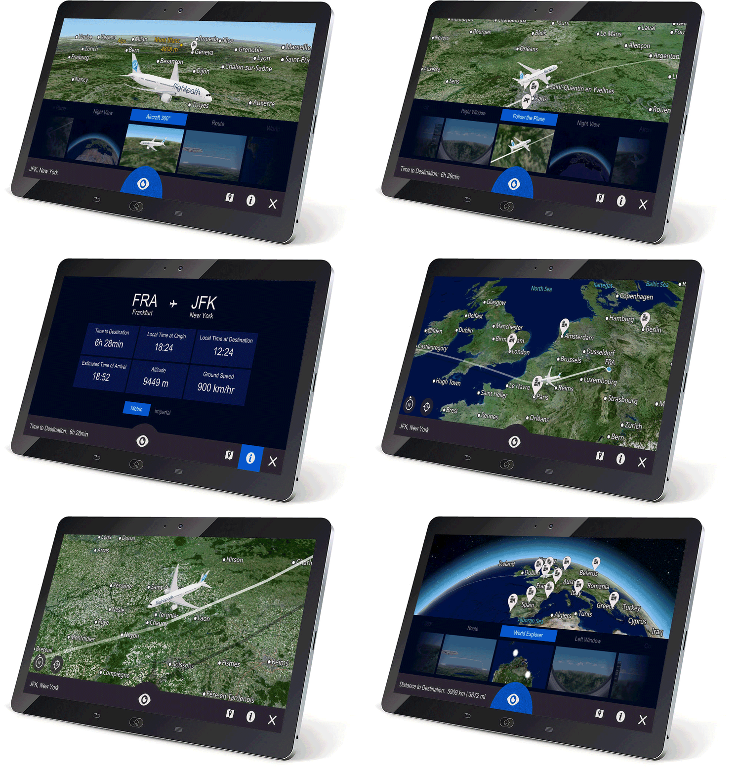
Follow the flight path in 3d
Fully customizable experience with aircraft livery, menus, icons, and content. Flight data, virtual window seat and pilot views.
RESPONSIVE DESIGN. ANY DEVICE. ANYWHERE.
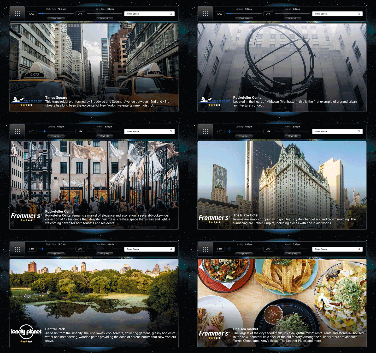
Explore Places and Plan Travel
Take a city tour with attraction reviews, trivia games, street maps, book an Uber, all customizable with your own content.
Any Content. Anywhere.

Immerse yourself in the journey
Surround yourself with a 360° panoramic aerial tour of a city or be ready for the thrill of an augmented pilot experience.
Awe-inspiring. Simply Amazing.
Upgrade to a fully-featured 3D experience
Passengers can choose from multiple perspective views including augmented window, pilot, flying over and many more.
Leave the confines of the plane and explore the world with free-roaming mode.

Real-Time flight data
View the flight data as the aircraft travels along its route.
Flight ticker shows how long the aircraft has been traveling and when it is landing.
Configurable data
Altitude, latitude, longitude, ground speed, true airspeed, heading, wind direction and more.
Direction to destination, distance traveled, distance to destination, total route distance, time since departure, time to destination and outside air temperature.

Fully customizable
Everything on the Moving Map is customizable. Configurable aircraft types and livery to render the exact aircraft and represent airline branding colors and logos, flight path display, screen icons, and fonts to match the airline’s passenger experience.
Drive Ancillary Revenue
All revenue-generating options are customizable as well. Airlines can include sponsorship and advertising screens, shopping micro-sites, ad rotation and more.

Point of Interest Displays
POI icons can be configured to display a small overlay, a complete micro-site with fully configurable location information or integrated into your existing interactive and e-commerce services.
Explore the city
Seamlessly integrated onto a backdrop of high-resolution satellite imagery, your passenger will find detailed, street-level road maps complete with street names, varying sized roadways, building outlines, parks, bridges, and major water bodies.

Our Curated Content
We’ve assembled and created our destination content to allow your passengers to explore cities, attractions, airports and other well-known POIs across the globe.
Access 3rd Party Authored Content
We have access to authored content for passengers to check out ratings from professional travel reviews by Fodor’s, Lonely Planet, Frommer’s, and Michelin Guide.
Allow your passengers to view these experienced independent ratings to help them plan their trip.

Content Management System
Create, edit, manage and organize destination graphics and multimedia files within our Destination Guide. We have an API and bulk load functions to simplify the technical integration.
Multi-Language Support
We continually add to the 20+ currently supported languages representing most of the major languages used commonly across the globe.
Interactive menus, place-names, window-shade portal screens, and POI content can all be served in any supported language.


